Visual Landscape Inventories conducted by RDI
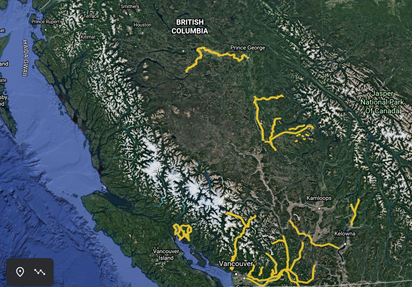
Google Earth KML, as seen from 1500 km in space, covering RDI's enormous history of Visual Landscape Inventory since 1996, mapping, photographing, and evaluating many major scenic highway corridors, challenging rivers, resource roads, remote lakes, and coastal inlets to Ministry of Forests, Lands, Natural Resource Operation and Rural Development (FLNRORD).
RDI welcomes the opportunity to provide oversight, analysis, and guidance leading to the completion of VLI's but is leaving the field work to our colleagues.
RDI uses a  Landscape Unit Rating Form digital speadsheet when rating visual landscape units. The spinners are used to select each specific rating.
The key document for conducting Visual Landscape Inventory in BC is the Visual Landscape Inventory Procedures and Training Manual, 1997.
See also the VRM Page for the same manual.
British Columbia
RDI has traversed many of British Columbia's scenic highways, rivers, coastal waterways, and lakes, conducting visual landscape inventories under contracts with the Ministry of Forests, Lands, Natural Resource Operations and Rural Development (FLNRORD) since 1996. Here is a partial list of coverage:
Chilliwack VLI Update 1996 - Trans Canada (HWY 1), Hope-Princeton (HWY 3), Coquihalla (HWY5) plus Harrison, Stave, Pitt, Wahleach, Nahatlach Lakes, Skagit Valley
Sea-to-Sky VLI - Highway 99 from Lions Bay to Darcy, Howe Sound waterway, Pemberton west to Meager Creek Hotspring.
Highway 97, 97a - Cariboo Forest District; Likely Road, Horsefly road, Horsefly Lake, Tisdal, McKinley, Moffat, Bosk, Crooked, and Elbow Lakes (jet boat, leaky canoe)
Okanagan- Merritt Highway 97c, Vernon to Sicamous
Moberly Lake to Fort St. John
Nechako River from Prince George to Cheslatta Falls (jet boat); Cripple and Otterson Lakes.
RDI offers VLI project oversight, analysis, mapping and guidance to our colleagues, while continuing our focus on visual impact assessment (VIA).
Ken Fairhurst also conducted the Northern Gulf Islands Coastal Waterways in 1985 during a one-year intercession from the Ministry Landscape Specialist in the Vancouver Forest Region (now the Coast Forest Region).
Looking further back to the start of the history of visual landscape inventory, commencing in 1980, Ken in his Ministry position participated in the earliest development of the VLI with Pem van Heek along the Alberni-Tofino Highway. Ken's early VLI maps were published in the BC Ministry of Forests, Forest Landscape Handbook 1981, pages 32 and 34. Sadly, that seminal document has not been found in digital format, but the hard copy version is found in many libraries currently searchable in
Worldcat: https://www.worldcat.org/title/forest-landscape-handbook/oclc/9303427. The Ministry is encouraged to produce a digital version which is essential to the on-going utility of this great document.
Some early press coverage for K. B. Fairhurst - Sea-to-Sky Visual Landscape Inventory 2006 - the Pique
While taking his PhD at UBC, Ken co-taught Forestry 491 with Dr. Stephen Sheppard. He also presented a general lecture on Visual Resource Management. In 2014, as Adjunct Professor in Forest Resources Management at UBC, Ken provided the laboratory side of Forestry 424 with teaching and practice of Visual Impact Assessment and 3-d simulation using Visual Nature Studio and GIS.
New: Check out our new and improved website at rdi3d.ca